Planning Your Visit
MAPS & GUIDES
Know where to go with Trail Maps & Resort Guides
Mt. Washington Alpine Resort is a year-round recreation destination located on Vancouver Island, British Columbia. In the winter guests enjoy accessing over 1,700 acres and 505 vertical metres of alpine terrain, 55kms of cross-country skiing, and 25kms of snowshoeing trails along with a dedicated Nordic lodge, Tube Park and Fat Bike trails. Learn more about resort terrain and offerings with trail map information below. Maps are also easily accessible from the Mount Washington Mobile App.

2025/26 WINTER RECREATION GUIDE ONLINE NOW
The Winter Rec Guide: Reserve Your Snow Sports Now!
Our 2025/26 Winter Snow Sports Recreation Guide is now available! Click to download the PDF or pick up a printed magazine at one of our island distribution locations. If you already know what program you’d like to book or are looking for more details, please contact us at [email protected] Our Rec Sales Agents are available via email and phone to assist with booking your experience.
Winter Maps
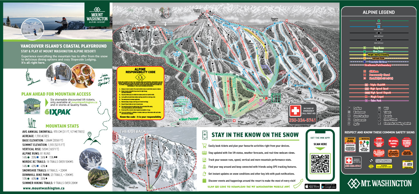
Full Alpine
Frontside and Outback Trail Maps
Download or view our 2024.25 Full Alpine Map to find your way around the Strathcona Park and the mountain at Mount Washington Alpine Resort. In the winter, guests enjoy accessing over 1,700 acres and 505 vertical metres of alpine terrain, 55 km of cross-country skiing, and 25 km of snowshoeing trails, along with a dedicated Nordic lodge, Tube Park and Fat Bike trails.
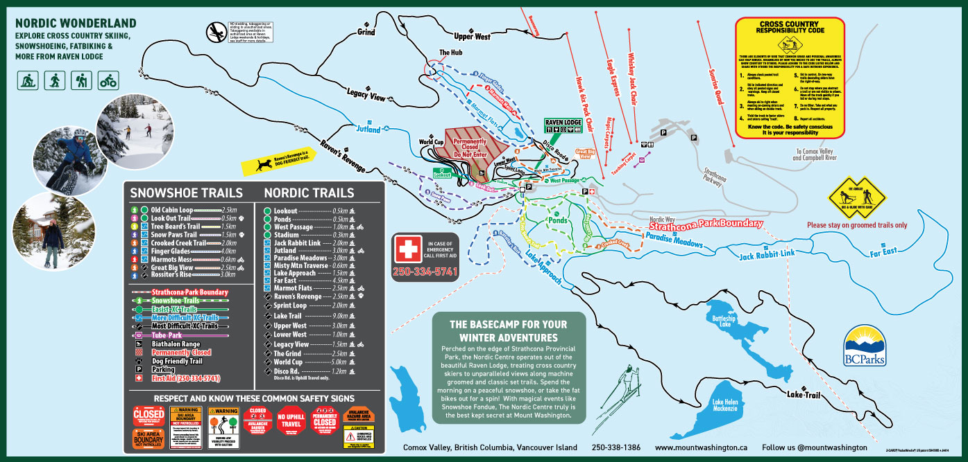
Full Nordic
Cross Country, Snowshoe, and Fat Bike Map
Download or view our Full Nordic Map to find your way around the Strathcona Park and the mountain at Mount Washington Alpine Resort. n the winter guests enjoy accessing over 1,700 acres and 505 vertical metres of alpine terrain, 55 kms of cross-country skiing, and 25kms of snowshoeing trails along with a dedicated Nordic lodge, Tube Park and Fat Bike trails.

The Outback
Trail Map
Download or view our Outback Terrain Winter Map to find your way around the backside mountain terrain at Mount Washington Alpine Resort. The Boomerang Chair is a unique down-and-back lift providing access to this double-black diamond terrain.
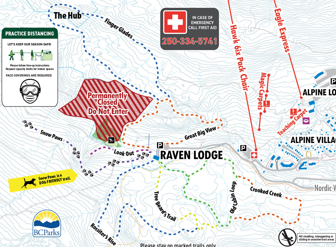
Snowshoe
Trail Map
Download or view our Snowshoe Trail Map to find your way around the Strathcona Park and the mountain at Mount Washington Alpine Resort. n the winter guests enjoy accessing over 1,700 acres and 505 vertical metres of alpine terrain, 55kms of cross-country skiing, and 25kms of snowshoeing trails along with a dedicated Nordic lodge, Tube Park and Fat Bike trails.
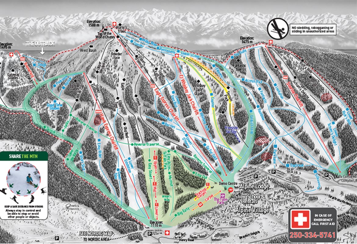
Alpine Winter
Trail Map
Download or view our Alpine Winter Map to find your way around the mountain at Mount Washington Alpine Resort. In the winter guests enjoy accessing over 1,700 acres and 505 vertical metres of alpine terrain, 55kms of cross-country skiing, and 25kms of snowshoeing trails along with a dedicated Nordic lodge, Tube Park and Fat Bike trails.

Nordic Trail Map
& Fat Bike Trails
Download or view our Nordic & Fat Bike Trail Map to find your way around the Strathcona Park and the mountain at Mount Washington Alpine Resort. In the winter guests enjoy accessing over 1,700 acres and 505 vertical metres of alpine terrain, 55kms of cross-country skiing, and 25 kms of snowshoeing trails along with a dedicated Nordic lodge, Tube Park and Fat Bike trails.
Summer Maps
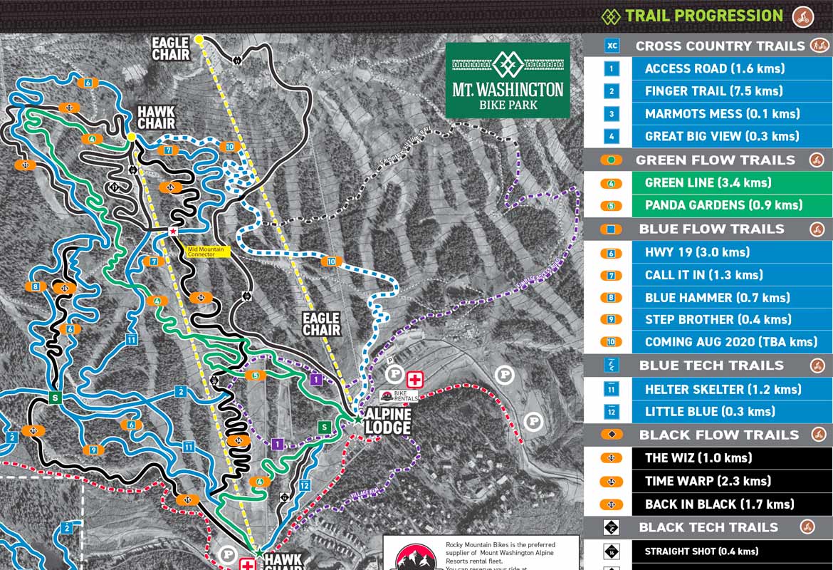
Bike Park
Preview your entire ride from top to bottom.
Download or view our Bike Park map to preview your entire ride. To reduce paper waste, and be sustainable we would invite our guests to utilize the Trailforks app to navigate the bike park, or download this map and keep it on their device. If you require a printed version of this map save it and print as needed.
All routes within the Bike Park are designated by colour-coded trail markers at the start of each descent. Trails with an orange oval indicate freeride trails with man-made features and may require jumping skills. Work your way up to more advanced trails and features based on your progression, skill and comfort level.
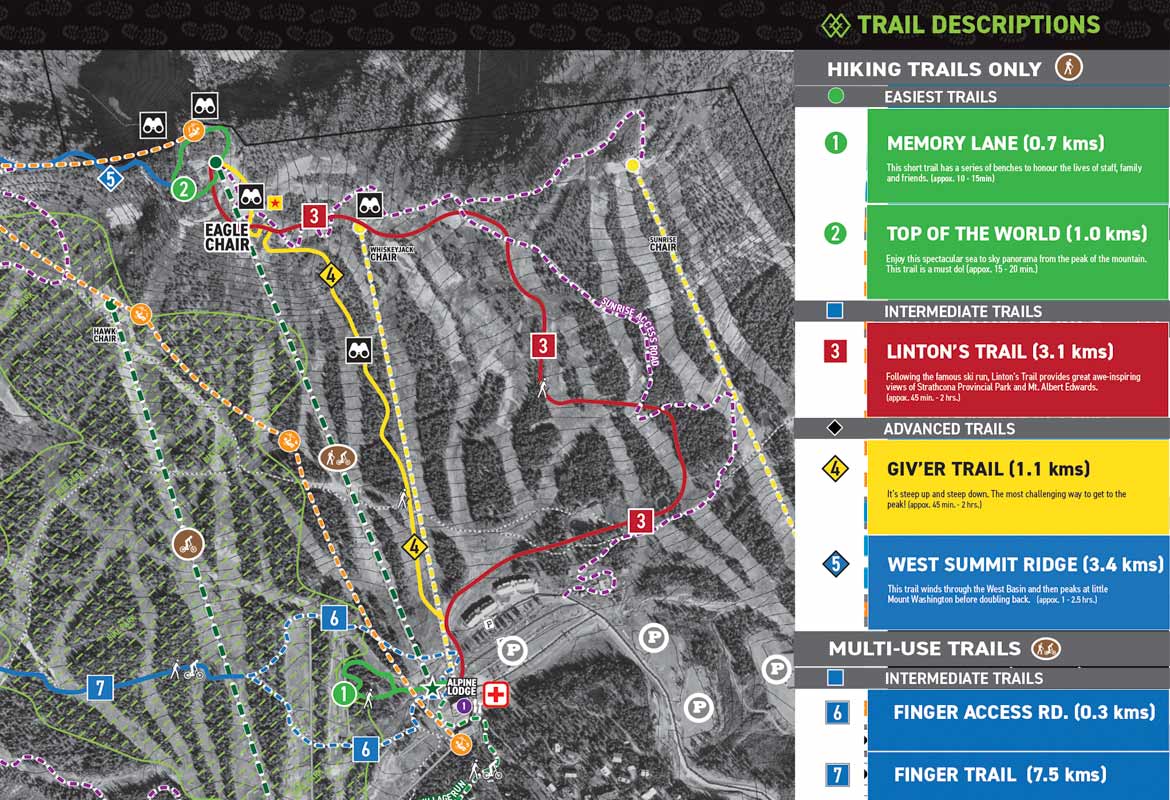
Summer Hiking Map
Preview our hiking trails at Mount Washington
Download or view our hiking trails map to preview your adventure on Mount Washington. Reduce paper waste and save this map to your device. These maps are not to scale and only meant to give a general idea on the trail direction and location. The trails are marked and flagged on hill.
To determine what you need to bring on a day hike, think about how far you plan to hike, how remote the location is and what the weather forecast has in store. In general, the longer and/or more remote the hike is and the more inclement the weather, the more clothing, gear, food and water you’re going to want. Mountain conditions can change quickly and unexpectedl
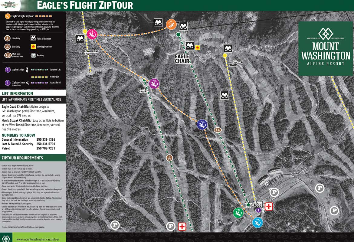
Ziptour
Preview the ride from top to bottom
Download or view our Ziptour map to preview the entire ride. A one-of-a-kind, bucket-list-worthy, high-flying adventure! Experience Vancouver Island’s longest combined and most thrilling zip line tour spanning across the stunning views of Mount Washington Alpine Resort. On the Eagle’s Flight ZipTour, enjoy 4 unique spans of zip lines with the ability to control your own speeds to throttle for thrills or hold back to savour the views. Unfold your wings and soar with the eagles this summer!
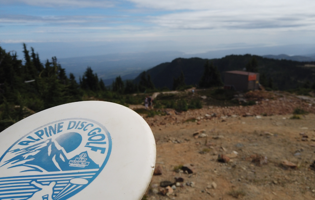
Disc Golf
Alpine Course Map
From the top of Eagle Chair, purchase Scenic Chairlift Access or ride free as a Mountain Pass Holder. 11 Hole Black Diamond course for advanced players leads you down to the Whiskey Jack Chair & 7 Hole Blue course for novice players stays higher up the mountain for an easier hike. Steep rocky gradients on ski runs, spotter recommended on downhill holes. Click to view scorecards and the course map on the UDisc website or mobile app. Discs can be rented or purchased from Outdoor Elements retail store.

Disc Golf
Lodge Course Map
From the Alpine Lodge Base. 9 Hole Green course perfect for beginner players leads you around the base of Mt. Washington and above the patio courtyard. Click to view scorecards and the course map on the UDisc website or mobile app. Discs can be rented or purchased from Outdoor Elements retail store.
Resort Maps
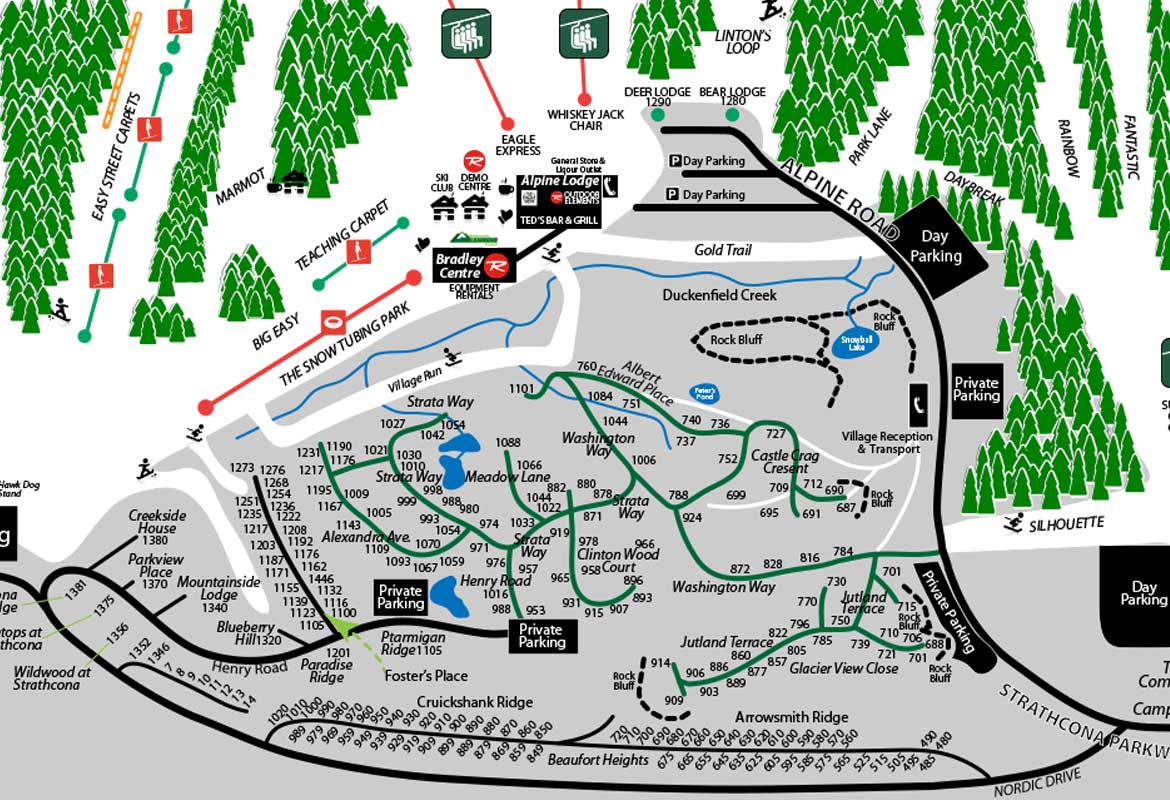
Village Map
Parking, village properties and area
Download or view the Village Accommodation and surrounding area building map to find your way around the mountain at Mount Washington Alpine Resort